

-

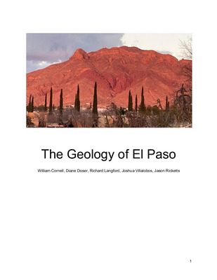
The Geology of El Paso
William Cornell, Diane Doser, Richard Langford, Joshua Villalobos, and Jason Ricketts
The Geology of El Paso describes the history of El Paso, Texas and its surrounding region from the Precambrian formation of the continent to the modern use of geologic resources. This book is written in an easy to digest format, with definitions or links for specific geologic terms and references for further reading. It reviews the formation and evolution of local landmark features such as the Franklin Mountains, Cerro Cristo Rey, and the Sierra de Juarez. Fossils and stratigraphic units of the El Paso area are described as well as important geologic features. The book puts the events that shaped El Paso in a regional plate tectonic framework that includes the processes that shaped Mexico as well as the United States. Precambrian events include the Proterozoic accretion of the Yavapai and Mazatzal terrains and the Grenville Orogeny. Important Carboniferous and Permian events that created the oil reserves in the region include the collision of South America to form Pangea and the Ancestral Rocky Mountains Orogeny. Cretaceous and Paleogene orogenic events of North America, including the Sevier and Laramide, brought renewed mountain building and basin formation to the region. Volcanism dominated the region in the Eocene, Oligocene and Miocene periods, forming many of the features of the local and regional landscape such as Cerro Cristo Rey. The Rio Grande rift is an active feature that continues to produce volcanic activity and earthquakes. The rift is superimposed upon older events, and has shaped the landscape into what we see today.
Printing is not supported at the primary Gallery Thumbnail page. Please first navigate to a specific Image before printing.